
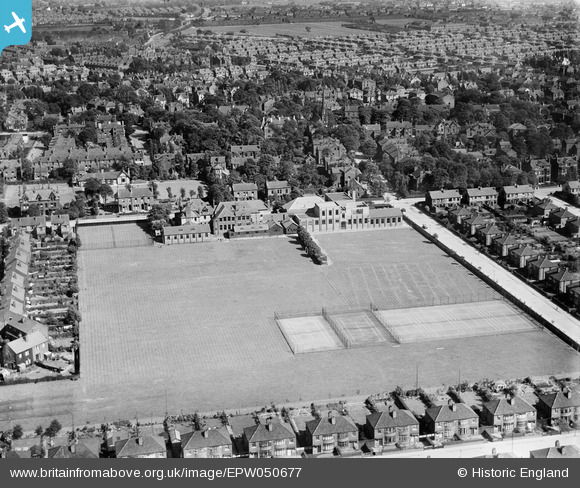
EPW050677 ENGLAND (1936). Withington Girls School and Playing Fields, Fallowfield, 1936
© Copyright OpenStreetMap contributors and licensed by the OpenStreetMap Foundation. 2026. Cartography is licensed as CC BY-SA.
Nearby Images (16)
EPW050677

EPW050674

EPW050676

EPW050679

EPW050680

EPW050681

EPW050683

EPW050675

EPW050684

EPW050682

EPW050678

EPW051918

EPW051917

EPW051920

EPW051921

EPW051919

Details
| Title | [EPW050677] Withington Girls School and Playing Fields, Fallowfield, 1936 |
| Reference | EPW050677 |
| Date | June-1936 |
| Link | |
| Place name | FALLOWFIELD |
| Parish | |
| District | |
| Country | ENGLAND |
| Easting / Northing | 385071, 393582 |
| Longitude / Latitude | -2.2247600711606, 53.438545863699 |
| National Grid Reference | SJ851936 |
Pins

petegarv |
Friday 27th of September 2013 01:46:38 PM | |
|
petegarv |
Friday 27th of September 2013 12:41:40 PM | |
|
petegarv |
Friday 27th of September 2013 12:38:36 PM | |
|
petegarv |
Friday 27th of September 2013 12:35:26 PM |