
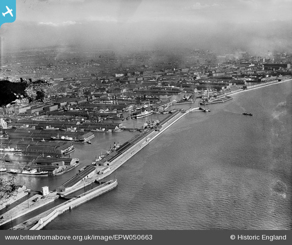
EPW050663 ENGLAND (1936). Alexandra Dock and the surrounding docks alongside the River Mersey, Bootle, from the north-west, 1936. This image has been produced from a damaged negative.
© Copyright OpenStreetMap contributors and licensed by the OpenStreetMap Foundation. 2026. Cartography is licensed as CC BY-SA.
Nearby Images (5)
EPW050663

EAW001709

EAW048046

EAW048045

EAW001708

Details
| Title | [EPW050663] Alexandra Dock and the surrounding docks alongside the River Mersey, Bootle, from the north-west, 1936. This image has been produced from a damaged negative. |
| Reference | EPW050663 |
| Date | June-1936 |
| Link | |
| Place name | BOOTLE |
| Parish | |
| District | |
| Country | ENGLAND |
| Easting / Northing | 332535, 395074 |
| Longitude / Latitude | -3.0159401575916, 53.447850161658 |
| National Grid Reference | SJ325951 |
Pins

austin |
Sunday 19th of April 2020 04:47:18 PM |