
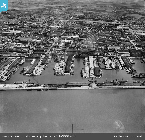
EAW001708 ENGLAND (1946). Alexandra and Langton Graving Docks and environs, Bootle, from the west, 1946
© Copyright OpenStreetMap contributors and licensed by the OpenStreetMap Foundation. 2026. Cartography is licensed as CC BY-SA.
Nearby Images (6)
EAW001708

EAW048045

EAW001709

EPW050663

EAW048046

EAW133870

Details
| Title | [EAW001708] Alexandra and Langton Graving Docks and environs, Bootle, from the west, 1946 |
| Reference | EAW001708 |
| Date | 11-July-1946 |
| Link | |
| Place name | BOOTLE |
| Parish | |
| District | |
| Country | ENGLAND |
| Easting / Northing | 332662, 394957 |
| Longitude / Latitude | -3.014002975907, 53.446814796008 |
| National Grid Reference | SJ327950 |
Pins

redmist |
Sunday 14th of February 2021 07:56:29 PM | |
|
redmist |
Sunday 14th of February 2021 07:55:35 PM | |
|
redmist |
Friday 12th of February 2021 10:16:09 AM | |
|
redmist |
Friday 12th of February 2021 10:07:56 AM | |
|
redmist |
Friday 12th of February 2021 09:49:05 AM | |
|
redmist |
Friday 12th of February 2021 09:47:06 AM | |
|
austin |
Sunday 19th of April 2020 10:17:54 PM | |
|
austin |
Sunday 19th of April 2020 10:14:11 PM | |
|
EmmaFairclough |
Tuesday 14th of April 2020 04:46:49 PM | |
|
ken |
Friday 17th of July 2015 11:28:00 AM | |
|
merseyman |
Monday 2nd of September 2013 09:43:24 PM | |
|
bootlegirl |
Sunday 25th of August 2013 12:35:43 PM | |
|
bootlegirl |
Sunday 25th of August 2013 12:34:03 PM |