
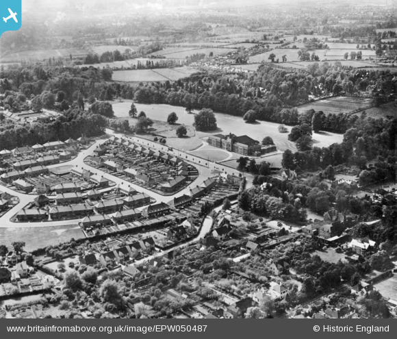
EPW050487 ENGLAND (1936). Headington School and environs, Headington, 1936. This image has been produced from a copy-negative.
© Copyright OpenStreetMap contributors and licensed by the OpenStreetMap Foundation. 2026. Cartography is licensed as CC BY-SA.
Nearby Images (8)
EPW050487

EAW023201

EAW003908

EAW023200

EAW049094

EAW023203

EAW023202

EAW003909

Details
| Title | [EPW050487] Headington School and environs, Headington, 1936. This image has been produced from a copy-negative. |
| Reference | EPW050487 |
| Date | June-1936 |
| Link | |
| Place name | HEADINGTON |
| Parish | |
| District | |
| Country | ENGLAND |
| Easting / Northing | 453868, 206773 |
| Longitude / Latitude | -1.2194754006071, 51.756598347712 |
| National Grid Reference | SP539068 |
Pins
Be the first to add a comment to this image!