
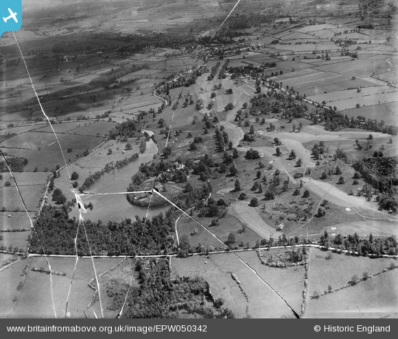
EPW050342 ENGLAND (1936). The pond and golf course at Willesley Park, Willesley, 1936. This image has been produced from a damaged negative.
© Copyright OpenStreetMap contributors and licensed by the OpenStreetMap Foundation. 2026. Cartography is licensed as CC BY-SA.
Nearby Images (7)
EPW050342

EPW050356

EPW050346

EPW050351

EPW050344

EPW050358

EPW050357

Details
| Title | [EPW050342] The pond and golf course at Willesley Park, Willesley, 1936. This image has been produced from a damaged negative. |
| Reference | EPW050342 |
| Date | June-1936 |
| Link | |
| Place name | WILLESLEY |
| Parish | ASHBY-DE-LA-ZOUCH |
| District | |
| Country | ENGLAND |
| Easting / Northing | 434188, 314786 |
| Longitude / Latitude | -1.493680878784, 52.729293413388 |
| National Grid Reference | SK342148 |
Pins
Be the first to add a comment to this image!