
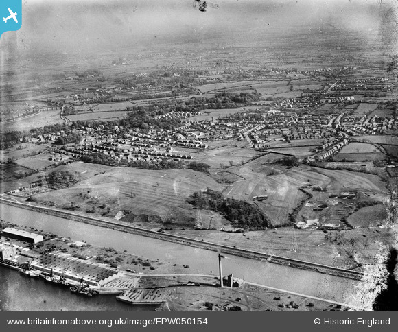
EPW050154 ENGLAND (1936). The River Ribble, the town and environs, Penwortham, from the north, 1936
© Copyright OpenStreetMap contributors and licensed by the OpenStreetMap Foundation. 2026. Cartography is licensed as CC BY-SA.
Nearby Images (2)
EPW050154

EPW050151

Details
| Title | [EPW050154] The River Ribble, the town and environs, Penwortham, from the north, 1936 |
| Reference | EPW050154 |
| Date | May-1936 |
| Link | |
| Place name | PENWORTHAM |
| Parish | PENWORTHAM |
| District | |
| Country | ENGLAND |
| Easting / Northing | 351397, 429078 |
| Longitude / Latitude | -2.7372353993569, 53.755574991117 |
| National Grid Reference | SD514291 |
Pins

peter |
Sunday 29th of December 2024 10:55:16 AM | |
|
peter |
Sunday 29th of December 2024 10:54:16 AM | |
|
Shary |
Thursday 29th of October 2020 09:14:16 PM | |
|
Shary |
Thursday 29th of October 2020 09:12:30 PM | |
|
Ragtag |
Sunday 20th of July 2014 06:10:52 PM |