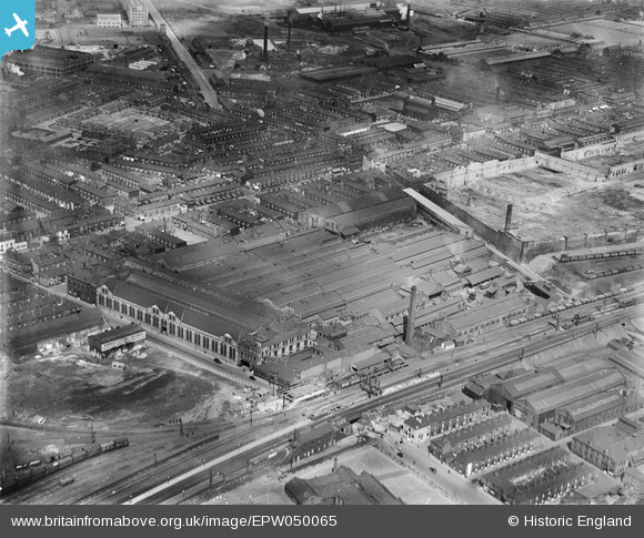
EPW050065 ENGLAND (1936). The Crossley Gas and Oil Engine Works, Openshaw, 1936
© Copyright OpenStreetMap contributors and licensed by the OpenStreetMap Foundation. 2026. Cartography is licensed as CC BY-SA.
Nearby Images (8)
Details
| Title | [EPW050065] The Crossley Gas and Oil Engine Works, Openshaw, 1936 |
| Reference | EPW050065 |
| Date | May-1936 |
| Link | |
| Place name | OPENSHAW |
| Parish | |
| District | |
| Country | ENGLAND |
| Easting / Northing | 387348, 397370 |
| Longitude / Latitude | -2.1906318968409, 53.472657586536 |
| National Grid Reference | SJ873974 |
Pins

papacho |
Monday 3rd of April 2023 12:43:55 AM | |

John Lawson |
Friday 17th of February 2023 09:12:57 AM | |

Barney Rubble |
Saturday 11th of April 2020 04:04:26 PM | |

moorsie |
Tuesday 24th of November 2015 10:40:36 AM | |

blueview |
Monday 17th of June 2013 11:29:59 AM |
User Comment Contributions
ashburys pottery lane bridge No6 new steel span on up side 21.5.36 |

wayne1212 |
Saturday 24th of January 2015 12:30:56 PM |


![[EPW050065] The Crossley Gas and Oil Engine Works, Openshaw, 1936](http://britainfromabove.org.uk/sites/all/libraries/aerofilms-images/public/100x100/EPW/050/EPW050065.jpg)
![[EPW019120] The Crossley Gas and Oil Engine Works, Openshaw, 1927](http://britainfromabove.org.uk/sites/all/libraries/aerofilms-images/public/100x100/EPW/019/EPW019120.jpg)
![[EPW050062] The Crossley Gas and Oil Engine Works, Openshaw, 1936](http://britainfromabove.org.uk/sites/all/libraries/aerofilms-images/public/100x100/EPW/050/EPW050062.jpg)
![[EPW050066] The Crossley Gas and Oil Engine Works, Openshaw, 1936](http://britainfromabove.org.uk/sites/all/libraries/aerofilms-images/public/100x100/EPW/050/EPW050066.jpg)
![[EPW050061] The Crossley Gas and Oil Engine Works, Openshaw, 1936](http://britainfromabove.org.uk/sites/all/libraries/aerofilms-images/public/100x100/EPW/050/EPW050061.jpg)
![[EPW050063] The Crossley Gas and Oil Engine Works, Openshaw, 1936](http://britainfromabove.org.uk/sites/all/libraries/aerofilms-images/public/100x100/EPW/050/EPW050063.jpg)
![[EPW050060] The Crossley Gas and Oil Engine Works, Openshaw, 1936](http://britainfromabove.org.uk/sites/all/libraries/aerofilms-images/public/100x100/EPW/050/EPW050060.jpg)
![[EPW050064] The Crossley Gas and Oil Engine Works, Openshaw, from the north-west, 1936](http://britainfromabove.org.uk/sites/all/libraries/aerofilms-images/public/100x100/EPW/050/EPW050064.jpg)