
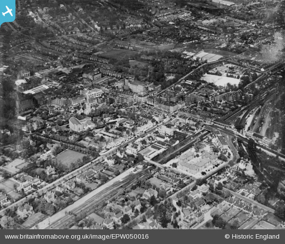
EPW050016 ENGLAND (1936). The town centre, Sutton, 1936. This image has been produced from a copy-negative.
© Copyright OpenStreetMap contributors and licensed by the OpenStreetMap Foundation. 2026. Cartography is licensed as CC BY-SA.
Nearby Images (18)
EPW050016

EPW006247

EPW011764

EPW028247

EPW057036

EPW006398

EPW050018

EPW001676

EPW057037

EAW022955

EPW057032

EPW011420

EPW011427

EPW011428

EAW022958

EPW057035

EPW028246

EPW050015

Details
| Title | [EPW050016] The town centre, Sutton, 1936. This image has been produced from a copy-negative. |
| Reference | EPW050016 |
| Date | May-1936 |
| Link | |
| Place name | SUTTON |
| Parish | |
| District | |
| Country | ENGLAND |
| Easting / Northing | 525924, 163958 |
| Longitude / Latitude | -0.19115401778742, 51.36021579979 |
| National Grid Reference | TQ259640 |
Pins

Joy |
Tuesday 25th of January 2022 03:37:49 PM | |
|
Joy |
Tuesday 25th of January 2022 03:06:09 PM | |
|
Kim |
Sunday 6th of June 2021 08:55:30 AM | |
|
Kim |
Sunday 6th of June 2021 08:54:34 AM | |
|
Kim |
Sunday 6th of June 2021 08:53:55 AM | |
|
Pbrags |
Sunday 16th of November 2014 12:24:44 PM | |
|
Geoff Smith |
Wednesday 12th of November 2014 11:17:29 AM | |
|
brianbeckett |
Wednesday 5th of November 2014 08:55:27 PM |