
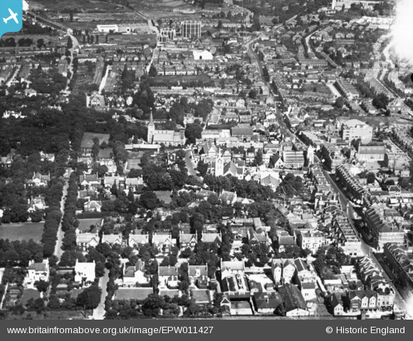
EPW011427 ENGLAND (1924). Church Road and the High Street, Sutton, 1924. This image has been produced from a print.
© Copyright OpenStreetMap contributors and licensed by the OpenStreetMap Foundation. 2026. Cartography is licensed as CC BY-SA.
Nearby Images (19)
EPW011427

EPW057037

EAW022955

EAW022958

EPW057032

EPW028245

EPW006398

EPW011764

EPW001674

EPW028239

EPW050016

EPW057033

EPW006247

EPW011420

EPW028249

EPW028247

EPW057036

EPW050018

EPW001676

Details
| Title | [EPW011427] Church Road and the High Street, Sutton, 1924. This image has been produced from a print. |
| Reference | EPW011427 |
| Date | July-1924 |
| Link | |
| Place name | SUTTON |
| Parish | |
| District | |
| Country | ENGLAND |
| Easting / Northing | 525828, 164096 |
| Longitude / Latitude | -0.19248344384089, 51.361477453853 |
| National Grid Reference | TQ258641 |
Pins

Joy |
Tuesday 25th of January 2022 02:51:24 PM | |
|
Joy |
Tuesday 25th of January 2022 02:50:18 PM | |
|
Joy |
Tuesday 25th of January 2022 02:49:32 PM | |
|
Kim |
Sunday 6th of June 2021 08:45:10 AM | |
|
Kim |
Sunday 6th of June 2021 08:43:40 AM | |
|
Kim |
Sunday 6th of June 2021 08:42:26 AM | |
|
Kim |
Sunday 6th of June 2021 08:40:41 AM | |
|
Kim |
Sunday 6th of June 2021 08:39:34 AM |