
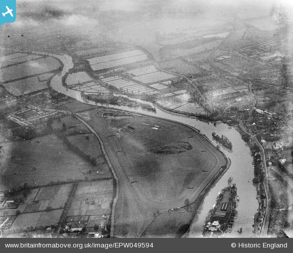
EPW049594 ENGLAND (1936). Hurst Park Racecourse and the River Thames, Hurst Park, 1936
© Copyright OpenStreetMap contributors and licensed by the OpenStreetMap Foundation. 2026. Cartography is licensed as CC BY-SA.
Nearby Images (7)
EPW049594

EPW041086

EPW009809

EPW028481

EPW022849

EPW001691

EAW030976

Details
| Title | [EPW049594] Hurst Park Racecourse and the River Thames, Hurst Park, 1936 |
| Reference | EPW049594 |
| Date | January-1936 |
| Link | |
| Place name | HURST PARK |
| Parish | |
| District | |
| Country | ENGLAND |
| Easting / Northing | 513646, 169140 |
| Longitude / Latitude | -0.36578258220956, 51.409386594522 |
| National Grid Reference | TQ136691 |
Pins

jill |
Sunday 21st of February 2016 04:46:22 PM |
User Comment Contributions
A strip of open land alongside the Thames, given to the council with a Deed of Gift for the local public to enjoy. |
jill |
Sunday 21st of February 2016 04:47:11 PM |