
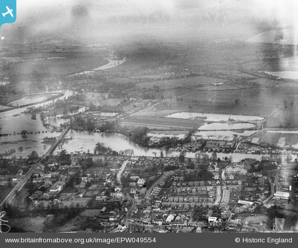
EPW049554 ENGLAND (1936). River Thames in flood around Walton Bridge, Walton-on-Thames, from the south-east, 1936
© Copyright OpenStreetMap contributors and licensed by the OpenStreetMap Foundation. 2025. Cartography is licensed as CC BY-SA.
Nearby Images (4)
EPW049554

EPW023464

EPW023467

EPW023465

Details
| Title | [EPW049554] River Thames in flood around Walton Bridge, Walton-on-Thames, from the south-east, 1936 |
| Reference | EPW049554 |
| Date | January-1936 |
| Link | |
| Place name | WALTON-ON-THAMES |
| Parish | |
| District | |
| Country | ENGLAND |
| Easting / Northing | 509942, 166518 |
| Longitude / Latitude | -0.41983607870037, 51.386547202773 |
| National Grid Reference | TQ099665 |
Pins

Anthony McKay |
Monday 26th of December 2022 08:07:55 PM |