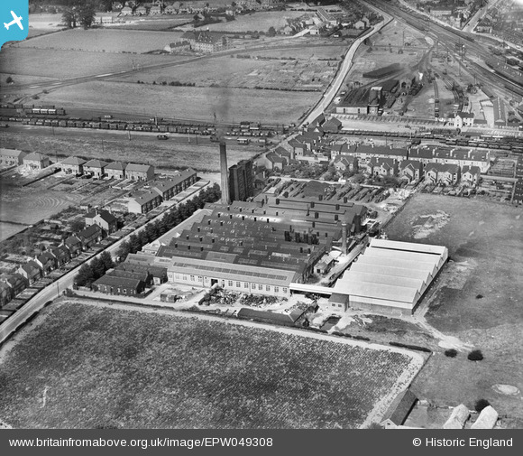
EPW049308 ENGLAND (1935). The British Ropes Ltd Rope Works on Ollerton Road, Retford, 1935
© Copyright OpenStreetMap contributors and licensed by the OpenStreetMap Foundation. 2026. Cartography is licensed as CC BY-SA.
Nearby Images (7)
Details
| Title | [EPW049308] The British Ropes Ltd Rope Works on Ollerton Road, Retford, 1935 |
| Reference | EPW049308 |
| Date | September-1935 |
| Link | |
| Place name | RETFORD |
| Parish | |
| District | |
| Country | ENGLAND |
| Easting / Northing | 470149, 379963 |
| Longitude / Latitude | -0.94700573154426, 53.3116802016 |
| National Grid Reference | SK701800 |
Pins

MB |
Friday 22nd of January 2021 02:38:38 PM | |

MB |
Friday 22nd of January 2021 02:38:10 PM | |

MB |
Friday 22nd of January 2021 02:36:47 PM | |

MB |
Friday 22nd of January 2021 02:35:35 PM | |

MB |
Friday 22nd of January 2021 02:34:58 PM | |

MB |
Friday 22nd of January 2021 02:34:06 PM | |

MB |
Friday 22nd of January 2021 02:32:24 PM | |

Grimsby Boy |
Saturday 17th of November 2018 07:17:41 PM |


![[EPW049308] The British Ropes Ltd Rope Works on Ollerton Road, Retford, 1935](http://britainfromabove.org.uk/sites/all/libraries/aerofilms-images/public/100x100/EPW/049/EPW049308.jpg)
![[EPW049309] The British Ropes Ltd Rope Works on Ollerton Road, Retford, 1935](http://britainfromabove.org.uk/sites/all/libraries/aerofilms-images/public/100x100/EPW/049/EPW049309.jpg)
![[EPW049304] The British Ropes Ltd Rope Works on Ollerton Road, Retford, 1935](http://britainfromabove.org.uk/sites/all/libraries/aerofilms-images/public/100x100/EPW/049/EPW049304.jpg)
![[EPW049310] The British Ropes Ltd Rope Works on Ollerton Road, Retford, 1935](http://britainfromabove.org.uk/sites/all/libraries/aerofilms-images/public/100x100/EPW/049/EPW049310.jpg)
![[EPW049305] The British Ropes Ltd Rope Works on Ollerton Road, Retford, 1935](http://britainfromabove.org.uk/sites/all/libraries/aerofilms-images/public/100x100/EPW/049/EPW049305.jpg)
![[EPW049306] The British Ropes Ltd Rope Works on Ollerton Road, Retford, 1935](http://britainfromabove.org.uk/sites/all/libraries/aerofilms-images/public/100x100/EPW/049/EPW049306.jpg)
![[EPW049307] The British Ropes Ltd Rope Works on Ollerton Road, Retford, 1935](http://britainfromabove.org.uk/sites/all/libraries/aerofilms-images/public/100x100/EPW/049/EPW049307.jpg)