
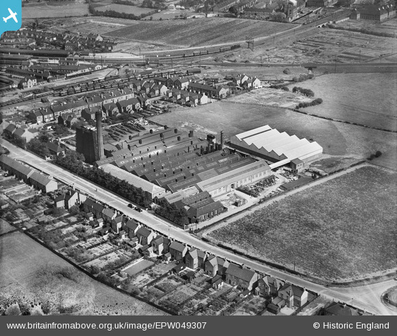
EPW049307 ENGLAND (1935). The British Ropes Ltd Rope Works on Ollerton Road, Retford, 1935
© Copyright OpenStreetMap contributors and licensed by the OpenStreetMap Foundation. 2026. Cartography is licensed as CC BY-SA.
Nearby Images (7)
EPW049307

EPW049306

EPW049305

EPW049310

EPW049304

EPW049308

EPW049309

Details
| Title | [EPW049307] The British Ropes Ltd Rope Works on Ollerton Road, Retford, 1935 |
| Reference | EPW049307 |
| Date | September-1935 |
| Link | |
| Place name | RETFORD |
| Parish | |
| District | |
| Country | ENGLAND |
| Easting / Northing | 470196, 379950 |
| Longitude / Latitude | -0.94630323111951, 53.31155712611 |
| National Grid Reference | SK702800 |
Pins

John Wass |
Wednesday 10th of May 2017 08:11:17 PM | |
|
PrioriesHistoricalSociety |
Friday 26th of September 2014 12:42:58 PM | |
Are you sure? I seem to think trains from Sheffield to Lincoln etc used the loop line from the Sheffield direction to enter Retford station from the north. (Insistently, this loop still exists and allows north bound trains to turn westwards towards Sheffield.) They then departed as seen on this photo turning left to rejoin their original path eastwards. The building of the fly-under just got rid of the flat crossing over the main line. |
John Wass |
Tuesday 13th of January 2015 08:41:02 PM |
|
PrioriesHistoricalSociety |
Friday 26th of September 2014 12:41:34 PM | |
|
PrioriesHistoricalSociety |
Friday 26th of September 2014 12:40:53 PM | |
|
PrioriesHistoricalSociety |
Friday 26th of September 2014 12:40:16 PM |