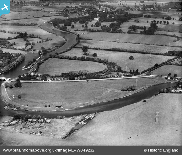
EPW049232 ENGLAND (1935). Chertsey Bridge Road and the Sports Ground, Chertsey, from the south-east, 1935
    © Copyright OpenStreetMap contributors and licensed by the OpenStreetMap Foundation. 2025. Cartography is licensed as CC BY-SA.
  
Nearby Images (5)
Details
| Title | [EPW049232] Chertsey Bridge Road and the Sports Ground, Chertsey, from the south-east, 1935 | 
| Reference | EPW049232 | 
| Date | October-1935 | 
| Link | |
| Place name | CHERTSEY | 
| Parish | |
| District | |
| Country | ENGLAND | 
| Easting / Northing | 505804, 166441 | 
| Longitude / Latitude | -0.47931033469876, 51.386641730193 | 
| National Grid Reference | TQ058664 | 
Pins
Be the first to add a comment to this image!
 
             
  ![[EPW049232] Chertsey Bridge Road and the Sports Ground, Chertsey, from the south-east, 1935](http://britainfromabove.org.uk/sites/all/libraries/aerofilms-images/public/100x100/EPW/049/EPW049232.jpg) 
  
                                          ![[EPW049231] Chertsey Bridge Road and the Sports Ground, Chertsey, from the south-east, 1935](http://britainfromabove.org.uk/sites/all/libraries/aerofilms-images/public/100x100/EPW/049/EPW049231.jpg) 
 ![[EPW049233] Chertsey Bridge Road and the Sports Ground with Laleham Abbey in the distance, Chertsey, from the south-east, 1935](http://britainfromabove.org.uk/sites/all/libraries/aerofilms-images/public/100x100/EPW/049/EPW049233.jpg) 
 ![[EPW049234] Chertsey Bridge Road and the Sports Ground, Chertsey, from the south-east, 1935](http://britainfromabove.org.uk/sites/all/libraries/aerofilms-images/public/100x100/EPW/049/EPW049234.jpg) 
 ![[EPW058804] The Chertsey Meads and surroundings, Chertsey, 1938. This image has been produced from a damaged negative.](http://britainfromabove.org.uk/sites/all/libraries/aerofilms-images/public/100x100/EPW/058/EPW058804.jpg)