
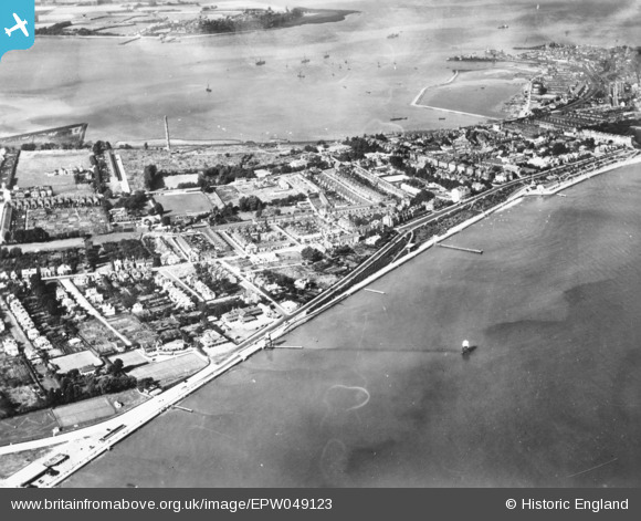
EPW049123 ENGLAND (1935). Dovercourt, Harwich, 1935. This image has been produced from a copy-negative.
© Copyright OpenStreetMap contributors and licensed by the OpenStreetMap Foundation. 2026. Cartography is licensed as CC BY-SA.
Nearby Images (3)
EPW049123

EPW039294

EAW043680

Details
| Title | [EPW049123] Dovercourt, Harwich, 1935. This image has been produced from a copy-negative. |
| Reference | EPW049123 |
| Date | August-1935 |
| Link | |
| Place name | HARWICH |
| Parish | HARWICH |
| District | |
| Country | ENGLAND |
| Easting / Northing | 625315, 231080 |
| Longitude / Latitude | 1.2778444025938, 51.932109846261 |
| National Grid Reference | TM253311 |
Pins

Dylan Moore |
Friday 14th of November 2014 10:22:47 PM |