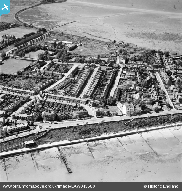
EAW043680 ENGLAND (1952). Oakland Road, Brooklyn Avenue and environs, Harwich, 1952
© Copyright OpenStreetMap contributors and licensed by the OpenStreetMap Foundation. 2026. Cartography is licensed as CC BY-SA.
Details
| Title | [EAW043680] Oakland Road, Brooklyn Avenue and environs, Harwich, 1952 |
| Reference | EAW043680 |
| Date | 4-June-1952 |
| Link | |
| Place name | HARWICH |
| Parish | HARWICH |
| District | |
| Country | ENGLAND |
| Easting / Northing | 625406, 231317 |
| Longitude / Latitude | 1.2793211700109, 51.934200578778 |
| National Grid Reference | TM254313 |
Pins
Be the first to add a comment to this image!


![[EAW043680] Oakland Road, Brooklyn Avenue and environs, Harwich, 1952](http://britainfromabove.org.uk/sites/all/libraries/aerofilms-images/public/100x100/EAW/043/EAW043680.jpg)
![[EAW043681] The Cliff Pavilion, Marine Parade and environs, Harwich, 1952](http://britainfromabove.org.uk/sites/all/libraries/aerofilms-images/public/100x100/EAW/043/EAW043681.jpg)
![[EPW039294] Marine Parade and the town, Harwich, from the south, 1932. This image has been produced from a copy-negative.](http://britainfromabove.org.uk/sites/all/libraries/aerofilms-images/public/100x100/EPW/039/EPW039294.jpg)
![[EPW049123] Dovercourt, Harwich, 1935. This image has been produced from a copy-negative.](http://britainfromabove.org.uk/sites/all/libraries/aerofilms-images/public/100x100/EPW/049/EPW049123.jpg)