
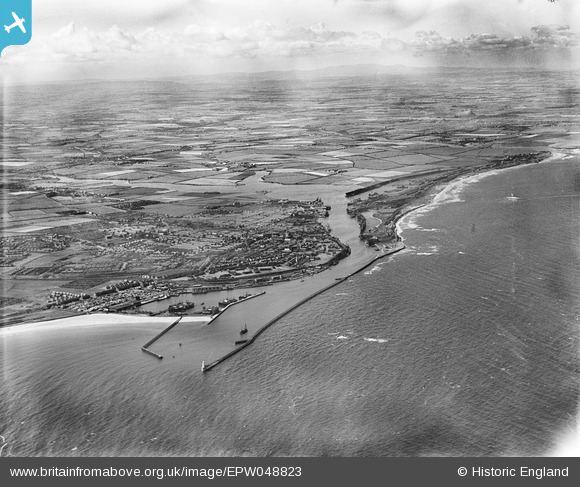
EPW048823 ENGLAND (1935). The harbour, town and surrounding countryside, Blyth, from the south-east, 1935
© Copyright OpenStreetMap contributors and licensed by the OpenStreetMap Foundation. 2026. Cartography is licensed as CC BY-SA.
Nearby Images (2)
EPW048823

EPW048838

Details
| Title | [EPW048823] The harbour, town and surrounding countryside, Blyth, from the south-east, 1935 |
| Reference | EPW048823 |
| Date | August-1935 |
| Link | |
| Place name | BLYTH |
| Parish | EAST BEDLINGTON |
| District | |
| Country | ENGLAND |
| Easting / Northing | 432452, 581033 |
| Longitude / Latitude | -1.4910842664285, 55.122558809197 |
| National Grid Reference | NZ325810 |
Pins
Be the first to add a comment to this image!