
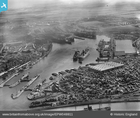
EPW048811 ENGLAND (1935). Tyne Dock, Jarrow, from the north-west, 1935
© Copyright OpenStreetMap contributors and licensed by the OpenStreetMap Foundation. 2026. Cartography is licensed as CC BY-SA.
Nearby Images (5)
EPW048811

EPW020192

EPW020192
EPW048815

EAW002156

Details
| Title | [EPW048811] Tyne Dock, Jarrow, from the north-west, 1935 |
| Reference | EPW048811 |
| Date | August-1935 |
| Link | |
| Place name | JARROW |
| Parish | |
| District | |
| Country | ENGLAND |
| Easting / Northing | 435194, 565607 |
| Longitude / Latitude | -1.4499895171779, 54.98374244467 |
| National Grid Reference | NZ352656 |
Pins

N Dunn |
Thursday 5th of April 2018 01:25:16 PM | |
|
N Dunn |
Thursday 5th of April 2018 01:22:41 PM |