
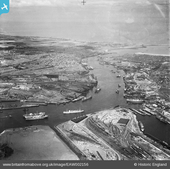
EAW002156 ENGLAND (1946). Shields Harbour, South Shields, from the south-west, 1946
© Copyright OpenStreetMap contributors and licensed by the OpenStreetMap Foundation. 2026. Cartography is licensed as CC BY-SA.
Nearby Images (3)
EAW002156

EPW048815

EPW048811

Details
| Title | [EAW002156] Shields Harbour, South Shields, from the south-west, 1946 |
| Reference | EAW002156 |
| Date | 1-August-1946 |
| Link | |
| Place name | SOUTH SHIELDS |
| Parish | |
| District | |
| Country | ENGLAND |
| Easting / Northing | 435006, 565815 |
| Longitude / Latitude | -1.4529020039141, 54.985624953475 |
| National Grid Reference | NZ350658 |
Pins

Coops |
Thursday 10th of March 2016 06:35:35 AM | |
|
N Dunn |
Monday 16th of September 2013 02:39:56 PM | |
|
N Dunn |
Monday 16th of September 2013 02:38:30 PM | |
 |
N Dunn |
Monday 16th of September 2013 02:32:11 PM |
 |
N Dunn |
Monday 16th of September 2013 02:27:06 PM |
|
N Dunn |
Monday 16th of September 2013 02:17:31 PM |