
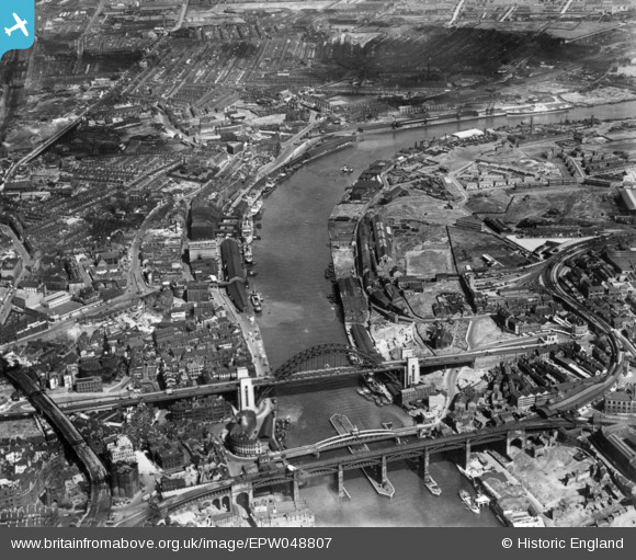
EPW048807 ENGLAND (1935). The High Level Bridge, Newcastle Swing Bridge, Tyne Bridge and environs, Newcastle upon Tyne, 1935. This image has been produced from a print.
© Copyright OpenStreetMap contributors and licensed by the OpenStreetMap Foundation. 2026. Cartography is licensed as CC BY-SA.
Nearby Images (22)
EPW048807

EPW051085

EPW051087

EPW051086

EPW048801

EAW600907

EPW051088

EPW051090

EPW051084

EPW051089

EAW037008

EAW037012

EAW037017

EPW048234

EAW037016

EAW037014

EAW037013

EPW048803

EAW037018

EAW037009

EAW037010

EPW048818

Details
| Title | [EPW048807] The High Level Bridge, Newcastle Swing Bridge, Tyne Bridge and environs, Newcastle upon Tyne, 1935. This image has been produced from a print. |
| Reference | EPW048807 |
| Date | August-1935 |
| Link | |
| Place name | NEWCASTLE UPON TYNE |
| Parish | |
| District | |
| Country | ENGLAND |
| Easting / Northing | 425665, 563952 |
| Longitude / Latitude | -1.5990517634678, 54.969451042334 |
| National Grid Reference | NZ257640 |
Pins

Ebo77 |
Friday 28th of February 2020 08:32:33 PM | |
|
Ebo77 |
Thursday 3rd of October 2019 09:46:57 PM | |
|
John Wass |
Friday 14th of December 2018 08:05:56 PM | |
|
John Wass |
Friday 14th of December 2018 08:03:53 PM | |

Dylan Moore |
Saturday 15th of November 2014 11:38:10 AM |