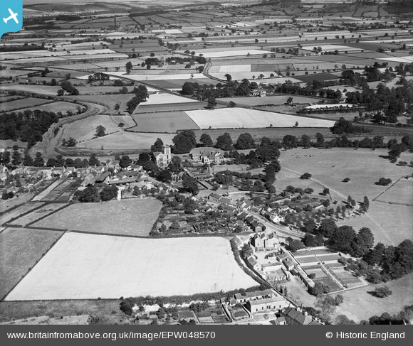
EPW048570 ENGLAND (1935). St Mary's Church, the village and surrounding countryside, Old Malton, 1935
    © Copyright OpenStreetMap contributors and licensed by the OpenStreetMap Foundation. 2025. Cartography is licensed as CC BY-SA.
  
Details
| Title | [EPW048570] St Mary's Church, the village and surrounding countryside, Old Malton, 1935 | 
| Reference | EPW048570 | 
| Date | July-1935 | 
| Link | |
| Place name | OLD MALTON | 
| Parish | MALTON | 
| District | |
| Country | ENGLAND | 
| Easting / Northing | 479851, 472491 | 
| Longitude / Latitude | -0.77751537223383, 54.141865738764 | 
| National Grid Reference | SE799725 | 
Pins
Be the first to add a comment to this image!
 
             
  ![[EPW048570] St Mary's Church, the village and surrounding countryside, Old Malton, 1935](http://britainfromabove.org.uk/sites/all/libraries/aerofilms-images/public/100x100/EPW/048/EPW048570.jpg) 
  
                                          ![[EPW048539] St Mary's Church and Town Street, Old Malton, 1935](http://britainfromabove.org.uk/sites/all/libraries/aerofilms-images/public/100x100/EPW/048/EPW048539.jpg) 
 ![[EPW048572] The Gannock, the village and surrounding countryside, Old Malton, 1935](http://britainfromabove.org.uk/sites/all/libraries/aerofilms-images/public/100x100/EPW/048/EPW048572.jpg) 
 ![[EPW048566] The village and surrounding countryside, Old Malton, 1935](http://britainfromabove.org.uk/sites/all/libraries/aerofilms-images/public/100x100/EPW/048/EPW048566.jpg)