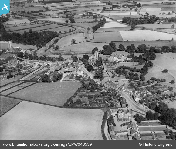
EPW048539 ENGLAND (1935). St Mary's Church and Town Street, Old Malton, 1935
    © Copyright OpenStreetMap contributors and licensed by the OpenStreetMap Foundation. 2025. Cartography is licensed as CC BY-SA.
  
Details
| Title | [EPW048539] St Mary's Church and Town Street, Old Malton, 1935 | 
| Reference | EPW048539 | 
| Date | July-1935 | 
| Link | |
| Place name | OLD MALTON | 
| Parish | MALTON | 
| District | |
| Country | ENGLAND | 
| Easting / Northing | 479770, 472554 | 
| Longitude / Latitude | -0.7787384757221, 54.142444468112 | 
| National Grid Reference | SE798726 | 
Pins
Be the first to add a comment to this image!
 
             
  ![[EPW048539] St Mary's Church and Town Street, Old Malton, 1935](http://britainfromabove.org.uk/sites/all/libraries/aerofilms-images/public/100x100/EPW/048/EPW048539.jpg) 
  
                                          ![[EPW048570] St Mary's Church, the village and surrounding countryside, Old Malton, 1935](http://britainfromabove.org.uk/sites/all/libraries/aerofilms-images/public/100x100/EPW/048/EPW048570.jpg) 
 ![[EPW048566] The village and surrounding countryside, Old Malton, 1935](http://britainfromabove.org.uk/sites/all/libraries/aerofilms-images/public/100x100/EPW/048/EPW048566.jpg) 
 ![[EPW048571] St Mary's Church, Town Street and surrounding countryside, Old Malton, 1935](http://britainfromabove.org.uk/sites/all/libraries/aerofilms-images/public/100x100/EPW/048/EPW048571.jpg)