
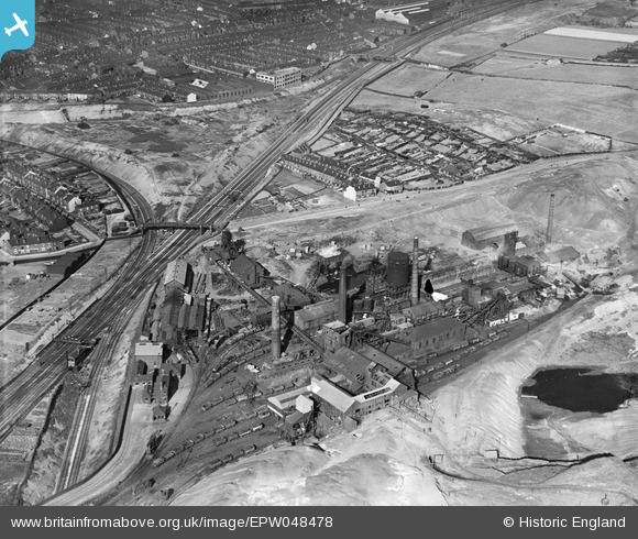
EPW048478 ENGLAND (1935). The Nunnery Colliery, Sheffield, 1935
© Copyright OpenStreetMap contributors and licensed by the OpenStreetMap Foundation. 2026. Cartography is licensed as CC BY-SA.
Nearby Images (10)
EPW048478

EPW048474

EPW048475

EPW048480

EPW048477

EPW048476

EPW048473

EPW048472

EPW048481

EPW048479

Details
| Title | [EPW048478] The Nunnery Colliery, Sheffield, 1935 |
| Reference | EPW048478 |
| Date | July-1935 |
| Link | |
| Place name | SHEFFIELD |
| Parish | |
| District | |
| Country | ENGLAND |
| Easting / Northing | 437824, 387790 |
| Longitude / Latitude | -1.4312576116872, 53.38533496572 |
| National Grid Reference | SK378878 |
Pins

Intitot |
Saturday 4th of April 2026 07:45:23 PM | |
|
Peter Turvey |
Tuesday 24th of September 2024 06:00:46 PM | |
|
RichardL |
Sunday 28th of September 2014 09:35:01 AM | |
|
RichardL |
Sunday 28th of September 2014 09:21:37 AM |