
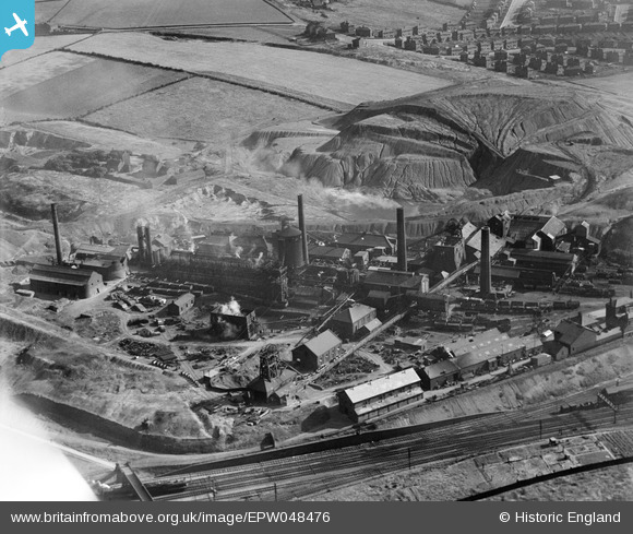
EPW048476 ENGLAND (1935). The Nunnery Colliery, Sheffield, 1935. This image has been affected by flare.
© Copyright OpenStreetMap contributors and licensed by the OpenStreetMap Foundation. 2026. Cartography is licensed as CC BY-SA.
Nearby Images (10)
EPW048476

EPW048477

EPW048473

EPW048475

EPW048480

EPW048474

EPW048478

EPW048479

EPW048481

EPW048472

Details
| Title | [EPW048476] The Nunnery Colliery, Sheffield, 1935. This image has been affected by flare. |
| Reference | EPW048476 |
| Date | July-1935 |
| Link | |
| Place name | SHEFFIELD |
| Parish | |
| District | |
| Country | ENGLAND |
| Easting / Northing | 437744, 387740 |
| Longitude / Latitude | -1.4324664481104, 53.38489122995 |
| National Grid Reference | SK377877 |
Pins

Peter Turvey |
Tuesday 24th of September 2024 05:58:55 PM | |
|
Mick. |
Tuesday 17th of August 2021 07:58:19 AM | |
|
Seamus610 |
Saturday 22nd of August 2020 04:32:01 PM | |
|
John Wass |
Friday 15th of May 2015 03:24:11 PM |