
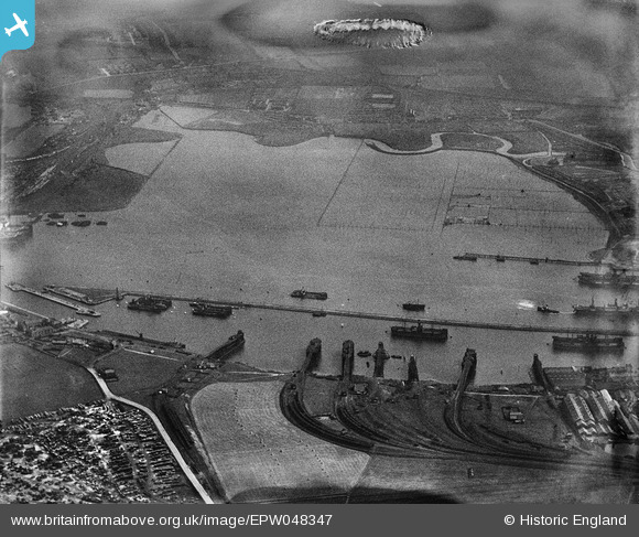
EPW048347 ENGLAND (1935). Jarrow Slake and Northumberland Dock, Jarrow, 1935. This image has been produced from a damaged negative.
© Copyright OpenStreetMap contributors and licensed by the OpenStreetMap Foundation. 2026. Cartography is licensed as CC BY-SA.
Nearby Images (3)
EPW048347

EPW048809

EPW025065

Details
| Title | [EPW048347] Jarrow Slake and Northumberland Dock, Jarrow, 1935. This image has been produced from a damaged negative. |
| Reference | EPW048347 |
| Date | July-1935 |
| Link | |
| Place name | JARROW |
| Parish | |
| District | |
| Country | ENGLAND |
| Easting / Northing | 434325, 565766 |
| Longitude / Latitude | -1.4635504904853, 54.985231995232 |
| National Grid Reference | NZ343658 |
