
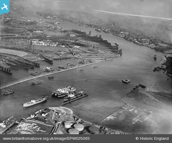
EPW025065 ENGLAND (1928). The Timber Yards, Northumberland Dock and Jarrow Slake Timber Ponds, East Howdon, from the south-west, 1928
© Copyright OpenStreetMap contributors and licensed by the OpenStreetMap Foundation. 2026. Cartography is licensed as CC BY-SA.
Nearby Images (4)
EPW025065

EPW048810

EPW048809

EPW048347

Details
| Title | [EPW025065] The Timber Yards, Northumberland Dock and Jarrow Slake Timber Ponds, East Howdon, from the south-west, 1928 |
| Reference | EPW025065 |
| Date | 14-October-1928 |
| Link | |
| Place name | EAST HOWDON |
| Parish | |
| District | |
| Country | ENGLAND |
| Easting / Northing | 434184, 565960 |
| Longitude / Latitude | -1.4657308523979, 54.986985140924 |
| National Grid Reference | NZ342660 |
Pins
 |

N Dunn |
Saturday 21st of September 2013 02:53:37 PM |

Dylan Moore |
Tuesday 6th of November 2012 02:22:13 PM |
User Comment Contributions
Albert Edward Dock, now Royal Quays. The huge building is now Commissioners Wharf. Lived there until 2001. |
allan1047 |
Sunday 15th of March 2015 01:52:03 PM |