
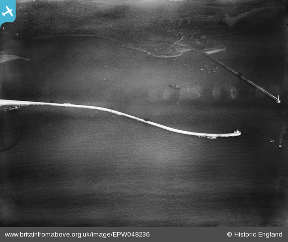
EPW048236 ENGLAND (1935). The South Pier at the entrance to the River Tyne, Tynemouth, 1935
© Copyright OpenStreetMap contributors and licensed by the OpenStreetMap Foundation. 2026. Cartography is licensed as CC BY-SA.
Nearby Images (3)
EPW048236

EPW048239

EPW048238

Details
| Title | [EPW048236] The South Pier at the entrance to the River Tyne, Tynemouth, 1935 |
| Reference | EPW048236 |
| Date | July-1935 |
| Link | |
| Place name | TYNEMOUTH |
| Parish | |
| District | |
| Country | ENGLAND |
| Easting / Northing | 438062, 568470 |
| Longitude / Latitude | -1.4047903946841, 55.009260584158 |
| National Grid Reference | NZ381685 |
Pins
Be the first to add a comment to this image!