
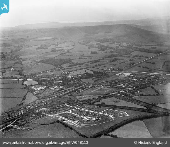
EPW048113 ENGLAND (1935). The town and surrounding countryside, Polegate, from the north-east, 1935
© Copyright OpenStreetMap contributors and licensed by the OpenStreetMap Foundation. 2026. Cartography is licensed as CC BY-SA.
Nearby Images (5)
EPW048113

 0°
0m
0°
0m
EPW048109
 129°
145m
129°
145m
EPW048111
 246°
145m
246°
145m
EPW048108
 30°
198m
30°
198m
EPW048112
 99°
232m
99°
232m
Details
| Title | [EPW048113] The town and surrounding countryside, Polegate, from the north-east, 1935 |
| Reference | EPW048113 |
| Date | July-1935 |
| Link | |
| Place name | POLEGATE |
| Parish | POLEGATE |
| District | |
| Country | ENGLAND |
| Easting / Northing | 558435, 104915 |
| Longitude / Latitude | 0.24959961003684, 50.8215107685 |
| National Grid Reference | TQ584049 |
Pins
 Railway branch line to Hailsham Railway branch line to Hailsham |

Kevin |
Saturday 10th of June 2017 04:39:37 PM |
| Polegate Level Crossing |
Kevin |
Saturday 10th of June 2017 04:38:19 PM |
| Wannock |
Kevin |
Saturday 10th of June 2017 04:36:57 PM |
| Folkington |
Kevin |
Saturday 10th of June 2017 04:36:31 PM |
| Diplocks Wood (Wannock Coppice) |
Kevin |
Saturday 10th of June 2017 04:35:45 PM |
| Polegate Crossroads |
Kevin |
Saturday 10th of June 2017 04:35:06 PM |
| Polegate Railway Station |
Kevin |
Saturday 10th of June 2017 04:34:33 PM |
| Central Avenue |
Kevin |
Saturday 10th of June 2017 04:33:48 PM |
| Polegate Windmill |
Michael |
Saturday 29th of October 2016 01:44:12 PM |