
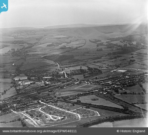
EPW048111 ENGLAND (1935). The town and surrounding countryside, Polegate, from the north-east, 1935
© Copyright OpenStreetMap contributors and licensed by the OpenStreetMap Foundation. 2026. Cartography is licensed as CC BY-SA.
Nearby Images (4)
EPW048111

 0°
0m
0°
0m
EPW048113
 66°
145m
66°
145m
EPW048109
 98°
249m
98°
249m
EPW048108
 45°
326m
45°
326m
Details
| Title | [EPW048111] The town and surrounding countryside, Polegate, from the north-east, 1935 |
| Reference | EPW048111 |
| Date | July-1935 |
| Link | |
| Place name | POLEGATE |
| Parish | POLEGATE |
| District | |
| Country | ENGLAND |
| Easting / Northing | 558302, 104857 |
| Longitude / Latitude | 0.24768767543456, 50.821025925309 |
| National Grid Reference | TQ583049 |
Pins
Be the first to add a comment to this image!