
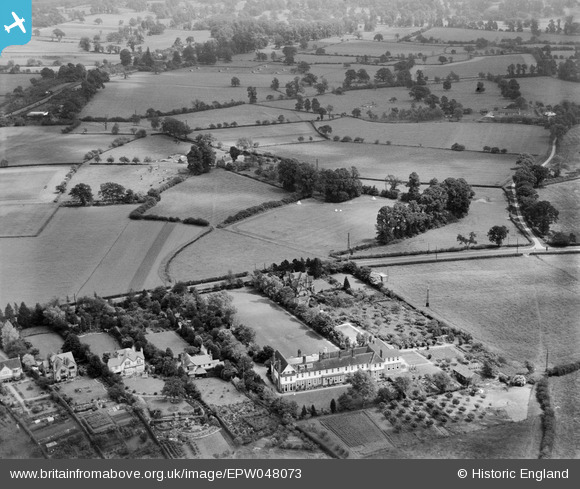
EPW048073 ENGLAND (1935). Worcester College for the Blind and fields off Whittington Road, Worcester, 1935
© Copyright OpenStreetMap contributors and licensed by the OpenStreetMap Foundation. 2024. Cartography is licensed as CC BY-SA.
Nearby Images (6)
EPW048073

EPW048072

EPW048075

EPW048074

EPW048077

EPW048076

Details
| Title | [EPW048073] Worcester College for the Blind and fields off Whittington Road, Worcester, 1935 |
| Reference | EPW048073 |
| Date | June-1935 |
| Link | |
| Place name | WORCESTER |
| Parish | |
| District | |
| Country | ENGLAND |
| Easting / Northing | 387287, 253522 |
| Longitude / Latitude | -2.1859463683033, 52.179400224974 |
| National Grid Reference | SO873535 |
Pins
 Newnsie567 |
Tuesday 22nd of November 2016 09:31:46 PM | |
Newnsie567 |
Tuesday 22nd of November 2016 09:31:45 PM | |
Newnsie567 |
Tuesday 22nd of November 2016 09:31:45 PM | |
Newnsie567 |
Tuesday 22nd of November 2016 09:31:11 PM | |
Newnsie567 |
Tuesday 22nd of November 2016 09:31:11 PM | |
Newnsie567 |
Tuesday 22nd of November 2016 09:31:10 PM |