
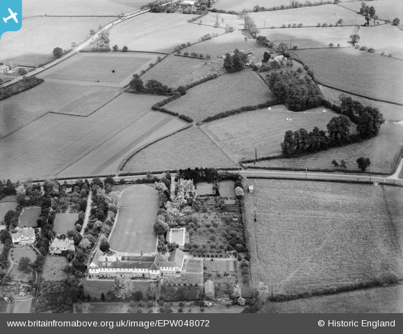
EPW048072 ENGLAND (1935). Worcester College for the Blind and fields off Whittington Road, Worcester, 1935
© Copyright OpenStreetMap contributors and licensed by the OpenStreetMap Foundation. 2024. Cartography is licensed as CC BY-SA.
Nearby Images (6)
EPW048072

EPW048074

EPW048075

EPW048073

EPW048077

EPW048076

Details
| Title | [EPW048072] Worcester College for the Blind and fields off Whittington Road, Worcester, 1935 |
| Reference | EPW048072 |
| Date | June-1935 |
| Link | |
| Place name | WORCESTER |
| Parish | |
| District | |
| Country | ENGLAND |
| Easting / Northing | 387233, 253508 |
| Longitude / Latitude | -2.1867356661992, 52.179273097728 |
| National Grid Reference | SO872535 |
Pins
 Newnsie567 |
Tuesday 22nd of November 2016 09:20:00 PM | |
Newnsie567 |
Tuesday 22nd of November 2016 09:19:13 PM |