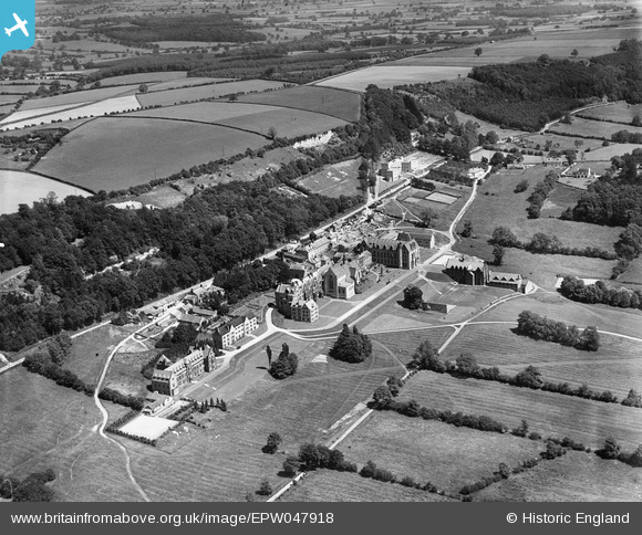
EPW047918 ENGLAND (1935). Ampleforth College and environs, Ampleforth, from the south-west, 1935
© Copyright OpenStreetMap contributors and licensed by the OpenStreetMap Foundation. 2025. Cartography is licensed as CC BY-SA.
Nearby Images (12)
Details
| Title | [EPW047918] Ampleforth College and environs, Ampleforth, from the south-west, 1935 |
| Reference | EPW047918 |
| Date | June-1935 |
| Link | |
| Place name | AMPLEFORTH |
| Parish | AMPLEFORTH |
| District | |
| Country | ENGLAND |
| Easting / Northing | 459674, 478769 |
| Longitude / Latitude | -1.0851215516272, 54.201027957754 |
| National Grid Reference | SE597788 |
Pins
Be the first to add a comment to this image!


![[EPW047918] Ampleforth College and environs, Ampleforth, from the south-west, 1935](http://britainfromabove.org.uk/sites/all/libraries/aerofilms-images/public/100x100/EPW/047/EPW047918.jpg)
![[EPW029504] Ampleforth Abbey and College, Ampleforth, 1929](http://britainfromabove.org.uk/sites/all/libraries/aerofilms-images/public/100x100/EPW/029/EPW029504.jpg)
![[EPW047908] Ampleforth College and environs, Ampleforth, from the south-west, 1935](http://britainfromabove.org.uk/sites/all/libraries/aerofilms-images/public/100x100/EPW/047/EPW047908.jpg)
![[EPW029503] Ampleforth Abbey and College, Ampleforth, 1929](http://britainfromabove.org.uk/sites/all/libraries/aerofilms-images/public/100x100/EPW/029/EPW029503.jpg)
![[EPW029506] Ampleforth Abbey and College, Ampleforth, 1929](http://britainfromabove.org.uk/sites/all/libraries/aerofilms-images/public/100x100/EPW/029/EPW029506.jpg)
![[EPW029500] Ampleforth Abbey and College, Ampleforth, 1929](http://britainfromabove.org.uk/sites/all/libraries/aerofilms-images/public/100x100/EPW/029/EPW029500.jpg)
![[EPW047910] Ampleforth College and environs, Ampleforth, 1935](http://britainfromabove.org.uk/sites/all/libraries/aerofilms-images/public/100x100/EPW/047/EPW047910.jpg)
![[EPW047916] Ampleforth College and environs, Ampleforth, from the south-west, 1935](http://britainfromabove.org.uk/sites/all/libraries/aerofilms-images/public/100x100/EPW/047/EPW047916.jpg)
![[EPW047912] Ampleforth College and environs, Ampleforth, 1935](http://britainfromabove.org.uk/sites/all/libraries/aerofilms-images/public/100x100/EPW/047/EPW047912.jpg)
![[EPW047913] Ampleforth College and environs, Ampleforth, 1935](http://britainfromabove.org.uk/sites/all/libraries/aerofilms-images/public/100x100/EPW/047/EPW047913.jpg)
![[EPW047909] Ampleforth College and environs, Ampleforth, 1935](http://britainfromabove.org.uk/sites/all/libraries/aerofilms-images/public/100x100/EPW/047/EPW047909.jpg)
![[EPW047914] Ampleforth College and environs, Ampleforth, from the south, 1935](http://britainfromabove.org.uk/sites/all/libraries/aerofilms-images/public/100x100/EPW/047/EPW047914.jpg)