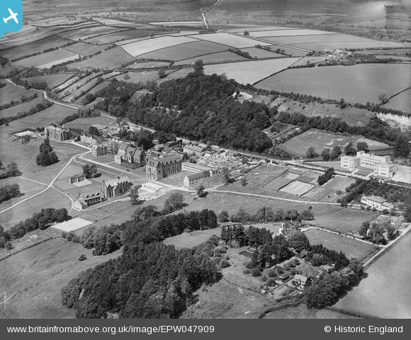
EPW047909 ENGLAND (1935). Ampleforth College and environs, Ampleforth, 1935
© Copyright OpenStreetMap contributors and licensed by the OpenStreetMap Foundation. 2025. Cartography is licensed as CC BY-SA.
Nearby Images (9)
Details
| Title | [EPW047909] Ampleforth College and environs, Ampleforth, 1935 |
| Reference | EPW047909 |
| Date | June-1935 |
| Link | |
| Place name | AMPLEFORTH |
| Parish | AMPLEFORTH |
| District | |
| Country | ENGLAND |
| Easting / Northing | 459884, 478901 |
| Longitude / Latitude | -1.0818761394465, 54.20218978743 |
| National Grid Reference | SE599789 |
Pins
Be the first to add a comment to this image!


![[EPW047909] Ampleforth College and environs, Ampleforth, 1935](http://britainfromabove.org.uk/sites/all/libraries/aerofilms-images/public/100x100/EPW/047/EPW047909.jpg)
![[EPW047913] Ampleforth College and environs, Ampleforth, 1935](http://britainfromabove.org.uk/sites/all/libraries/aerofilms-images/public/100x100/EPW/047/EPW047913.jpg)
![[EPW047912] Ampleforth College and environs, Ampleforth, 1935](http://britainfromabove.org.uk/sites/all/libraries/aerofilms-images/public/100x100/EPW/047/EPW047912.jpg)
![[EPW047910] Ampleforth College and environs, Ampleforth, 1935](http://britainfromabove.org.uk/sites/all/libraries/aerofilms-images/public/100x100/EPW/047/EPW047910.jpg)
![[EPW029500] Ampleforth Abbey and College, Ampleforth, 1929](http://britainfromabove.org.uk/sites/all/libraries/aerofilms-images/public/100x100/EPW/029/EPW029500.jpg)
![[EPW029506] Ampleforth Abbey and College, Ampleforth, 1929](http://britainfromabove.org.uk/sites/all/libraries/aerofilms-images/public/100x100/EPW/029/EPW029506.jpg)
![[EPW029503] Ampleforth Abbey and College, Ampleforth, 1929](http://britainfromabove.org.uk/sites/all/libraries/aerofilms-images/public/100x100/EPW/029/EPW029503.jpg)
![[EPW029504] Ampleforth Abbey and College, Ampleforth, 1929](http://britainfromabove.org.uk/sites/all/libraries/aerofilms-images/public/100x100/EPW/029/EPW029504.jpg)
![[EPW047918] Ampleforth College and environs, Ampleforth, from the south-west, 1935](http://britainfromabove.org.uk/sites/all/libraries/aerofilms-images/public/100x100/EPW/047/EPW047918.jpg)