
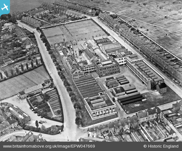
EPW047669 ENGLAND (1935). The Lotus Shoe Factory, Stafford, 1935
© Copyright OpenStreetMap contributors and licensed by the OpenStreetMap Foundation. 2026. Cartography is licensed as CC BY-SA.
Nearby Images (26)
EPW047669

EPW047663

EPW047320

EPW047326

EPW047667

EPW047670

EAW016402

EPW047666

EPW047321

EPW047319

EPW047664

EPW047322

EPW047323

EPW047665

EPW047668

EPW047324

EPW014118

EPW047325

EAW016403

EAW016407

EAW016404

EAW016405

EPW053372

EAW016406

EAW016398

EPW047336

Details
| Title | [EPW047669] The Lotus Shoe Factory, Stafford, 1935 |
| Reference | EPW047669 |
| Date | June-1935 |
| Link | |
| Place name | STAFFORD |
| Parish | |
| District | |
| Country | ENGLAND |
| Easting / Northing | 392501, 324361 |
| Longitude / Latitude | -2.1112806094384, 52.816406650826 |
| National Grid Reference | SJ925244 |
Pins
Be the first to add a comment to this image!