
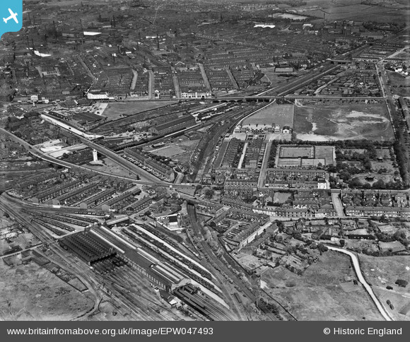
EPW047493 ENGLAND (1935). Knowsley Street Station and the town, Bury, from the west, 1935
© Copyright OpenStreetMap contributors and licensed by the OpenStreetMap Foundation. 2026. Cartography is licensed as CC BY-SA.
Nearby Images (8)
EPW047493

EPW048657

EPW048638

EPW048640

EPW047494

EPW048642

EPW047496

EPW046164

Details
| Title | [EPW047493] Knowsley Street Station and the town, Bury, from the west, 1935 |
| Reference | EPW047493 |
| Date | May-1935 |
| Link | |
| Place name | BURY |
| Parish | |
| District | |
| Country | ENGLAND |
| Easting / Northing | 380063, 410102 |
| Longitude / Latitude | -2.3012070548624, 53.586883766425 |
| National Grid Reference | SD801101 |
Pins

olivos |
Friday 1st of November 2019 04:11:56 PM | |
|
olivos |
Thursday 3rd of October 2019 11:59:53 AM | |
|
olivos |
Thursday 3rd of October 2019 11:57:07 AM | |

Class31 |
Monday 1st of September 2014 03:10:58 PM | |
|
Class31 |
Monday 1st of September 2014 03:10:21 PM | |
 |
Class31 |
Monday 1st of September 2014 03:09:47 PM |
|
Class31 |
Monday 1st of September 2014 03:09:12 PM |


