
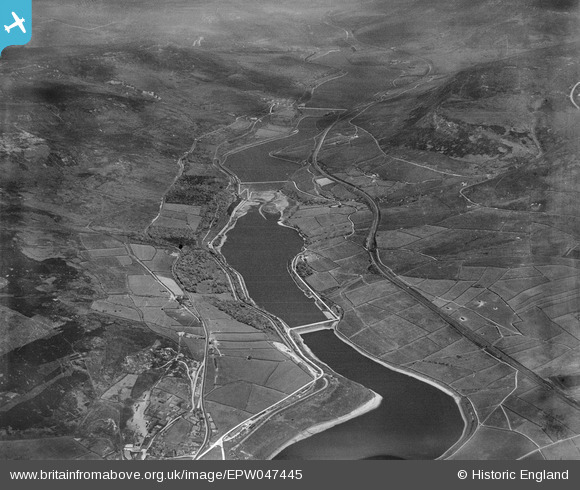
EPW047445 ENGLAND (1935). Bottoms, Valehouse, Rhodeswood and Torside Reservoirs, Longdendale, from the south-west, 1935
© Copyright OpenStreetMap contributors and licensed by the OpenStreetMap Foundation. 2025. Cartography is licensed as CC BY-SA.
Nearby Images (3)
EPW047445

EPW047444

EPW047447

Details
| Title | [EPW047445] Bottoms, Valehouse, Rhodeswood and Torside Reservoirs, Longdendale, from the south-west, 1935 |
| Reference | EPW047445 |
| Date | May-1935 |
| Link | |
| Place name | LONGDENDALE |
| Parish | TINTWISTLE |
| District | |
| Country | ENGLAND |
| Easting / Northing | 403190, 397411 |
| Longitude / Latitude | -1.9519346546192, 53.473168532486 |
| National Grid Reference | SK032974 |
Pins
Be the first to add a comment to this image!