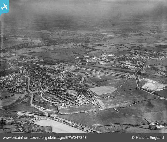
EPW047343 ENGLAND (1935). The town, Welwyn Garden City, from the south-west, 1935
© Copyright OpenStreetMap contributors and licensed by the OpenStreetMap Foundation. 2026. Cartography is licensed as CC BY-SA.
Nearby Images (8)
Details
| Title | [EPW047343] The town, Welwyn Garden City, from the south-west, 1935 |
| Reference | EPW047343 |
| Date | May-1935 |
| Link | |
| Place name | WELWYN GARDEN CITY |
| Parish | |
| District | |
| Country | ENGLAND |
| Easting / Northing | 522887, 212151 |
| Longitude / Latitude | -0.21789047398877, 51.794043370963 |
| National Grid Reference | TL229122 |
Pins

TerryB |
Tuesday 27th of August 2013 07:13:07 PM |


![[EPW047343] The town, Welwyn Garden City, from the south-west, 1935](http://britainfromabove.org.uk/sites/all/libraries/aerofilms-images/public/100x100/EPW/047/EPW047343.jpg)
![[EPW025534] Handside, Welwyn Garden City, from the south, 1928. This image has been produced from a damaged negative.](http://britainfromabove.org.uk/sites/all/libraries/aerofilms-images/public/100x100/EPW/025/EPW025534.jpg)
![[EPW022039] Elmwood and Attimore Road residences, Welwyn Garden City, 1928](http://britainfromabove.org.uk/sites/all/libraries/aerofilms-images/public/100x100/EPW/022/EPW022039.jpg)
![[EPW047350] Elmwood and environs, Welwyn Garden City, 1935](http://britainfromabove.org.uk/sites/all/libraries/aerofilms-images/public/100x100/EPW/047/EPW047350.jpg)
![[EPW022037] Elmwood and Attimore Road residences, Welwyn Garden City, 1928](http://britainfromabove.org.uk/sites/all/libraries/aerofilms-images/public/100x100/EPW/022/EPW022037.jpg)
![[EAW035462] The town and surrounding countryside, Welwyn Garden City, from the west, 1951. This image has been produced from a print marked by Aerofilms Ltd for photo editing.](http://britainfromabove.org.uk/sites/all/libraries/aerofilms-images/public/100x100/EAW/035/EAW035462.jpg)
![[EPW047348] Handside, Welwyn Garden City, 1935](http://britainfromabove.org.uk/sites/all/libraries/aerofilms-images/public/100x100/EPW/047/EPW047348.jpg)
![[EPW047349] Elmwood and environs, Welwyn Garden City, 1935](http://britainfromabove.org.uk/sites/all/libraries/aerofilms-images/public/100x100/EPW/047/EPW047349.jpg)