
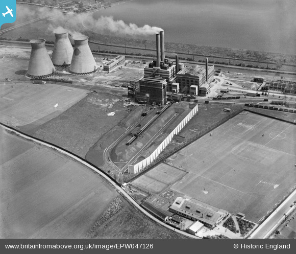
EPW047126 ENGLAND (1935). The Brimsdown Power Station and Water Coolers, Brimsdown, 1935
© Copyright OpenStreetMap contributors and licensed by the OpenStreetMap Foundation. 2026. Cartography is licensed as CC BY-SA.
Nearby Images (30)
EPW047126

EPW047124

EPW047125

EPW047127

EPW021170

EPW047123

EAW000005

EPW047128

EAW000010

EPW047122

EAW005266

EPW028510

EPW028509

EPW017355

EPW008035

EPW025597

EPW017356

EPW028508

EPW028513

EPW025595

EPW028512

EPW028507

EAW005267

EPW008047

EPW028511

EPW008033

EPW008036

EPW017354

EPW017348

EAW000004

Details
| Title | [EPW047126] The Brimsdown Power Station and Water Coolers, Brimsdown, 1935 |
| Reference | EPW047126 |
| Date | May-1935 |
| Link | |
| Place name | BRIMSDOWN |
| Parish | |
| District | |
| Country | ENGLAND |
| Easting / Northing | 536801, 197478 |
| Longitude / Latitude | -0.021998420128061, 51.65894998515 |
| National Grid Reference | TQ368975 |
Pins
Be the first to add a comment to this image!