
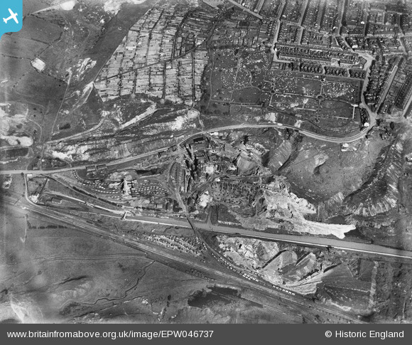
EPW046737 ENGLAND (1935). Goldendale Iron Works and Tunstall Cemetery, Tunstall, 1935
© Copyright OpenStreetMap contributors and licensed by the OpenStreetMap Foundation. 2026. Cartography is licensed as CC BY-SA.
Nearby Images (9)
EPW046737

EPW046735

EPW046742

EPW046743

EPW046738

EPW046736

EPW046739

EPW046740

EPW046741

Details
| Title | [EPW046737] Goldendale Iron Works and Tunstall Cemetery, Tunstall, 1935 |
| Reference | EPW046737 |
| Date | March-1935 |
| Link | |
| Place name | TUNSTALL |
| Parish | |
| District | |
| Country | ENGLAND |
| Easting / Northing | 385161, 351569 |
| Longitude / Latitude | -2.2214463347146, 53.060861122129 |
| National Grid Reference | SJ852516 |
Pins

machineage |
Wednesday 28th of August 2024 02:41:45 AM |