
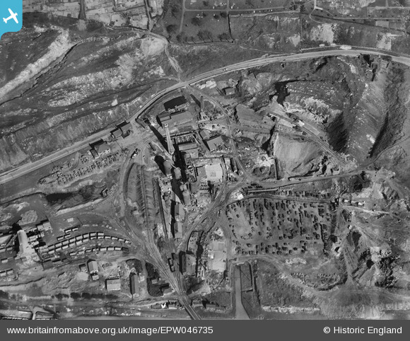
EPW046735 ENGLAND (1935). Goldendale Iron Works, Tunstall, 1935
© Copyright OpenStreetMap contributors and licensed by the OpenStreetMap Foundation. 2026. Cartography is licensed as CC BY-SA.
Nearby Images (9)
EPW046735

EPW046737

EPW046742

EPW046743

EPW046736

EPW046738

EPW046739

EPW046740

EPW046741

Details
| Title | [EPW046735] Goldendale Iron Works, Tunstall, 1935 |
| Reference | EPW046735 |
| Date | March-1935 |
| Link | |
| Place name | TUNSTALL |
| Parish | |
| District | |
| Country | ENGLAND |
| Easting / Northing | 385166, 351566 |
| Longitude / Latitude | -2.2213715807424, 53.060834290791 |
| National Grid Reference | SJ852516 |
Pins

Peter Turvey |
Sunday 23rd of November 2014 10:34:40 PM |
User Comment Contributions
I remember the golden glow in the sky from this ironworks, at the other end of the Chatterley valley from my parents' house. |
Carusus |
Saturday 14th of May 2016 03:18:59 PM |