
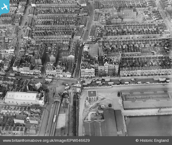
EPW046629 ENGLAND (1935). Poplar Hospital, East India Dock Road and environs, Poplar, 1935
© Copyright OpenStreetMap contributors and licensed by the OpenStreetMap Foundation. 2026. Cartography is licensed as CC BY-SA.
Nearby Images (9)
EPW046629

EPW046626

EPW046627

EPW046628

EPW046625

EPW046630

EAW022763

EAW022762

EAW099748

Details
| Title | [EPW046629] Poplar Hospital, East India Dock Road and environs, Poplar, 1935 |
| Reference | EPW046629 |
| Date | March-1935 |
| Link | |
| Place name | POPLAR |
| Parish | |
| District | |
| Country | ENGLAND |
| Easting / Northing | 538383, 181080 |
| Longitude / Latitude | -0.0056041620146201, 51.51119535399 |
| National Grid Reference | TQ384811 |
Pins

Chaz |
Wednesday 29th of January 2025 09:48:19 PM |