
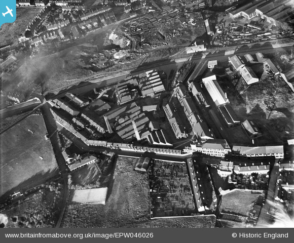
EPW046026 ENGLAND (1934). Brades Steel Works, Oldbury, 1934
© Copyright OpenStreetMap contributors and licensed by the OpenStreetMap Foundation. 2026. Cartography is licensed as CC BY-SA.
Nearby Images (14)
EPW046026

EPW046022

EPW046028

EPW046023

EPW046025

EPW046024

EPW046030

EPW046027

EPW046029

EAW001215

EPW046086

EPW046041

EPW046082

EPW046080

Details
| Title | [EPW046026] Brades Steel Works, Oldbury, 1934 |
| Reference | EPW046026 |
| Date | September-1934 |
| Link | |
| Place name | OLDBURY |
| Parish | |
| District | |
| Country | ENGLAND |
| Easting / Northing | 398187, 289834 |
| Longitude / Latitude | -2.0267139167574, 52.50603279908 |
| National Grid Reference | SO982898 |
Pins
Be the first to add a comment to this image!