
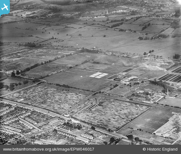
EPW046017 ENGLAND (1934). Edmonton Urban District Council Sewage Farm, Edmonton, from the west, 1934
© Copyright OpenStreetMap contributors and licensed by the OpenStreetMap Foundation. 2026. Cartography is licensed as CC BY-SA.
Nearby Images (3)
EPW046017

EPW031936

EPW046013

Details
| Title | [EPW046017] Edmonton Urban District Council Sewage Farm, Edmonton, from the west, 1934 |
| Reference | EPW046017 |
| Date | September-1934 |
| Link | |
| Place name | EDMONTON |
| Parish | |
| District | |
| Country | ENGLAND |
| Easting / Northing | 535374, 193417 |
| Longitude / Latitude | -0.044189657157474, 51.622799181093 |
| National Grid Reference | TQ354934 |
Pins

john ruscoe |
Saturday 2nd of November 2013 06:36:29 AM | |
|
john ruscoe |
Saturday 2nd of November 2013 06:35:55 AM |