
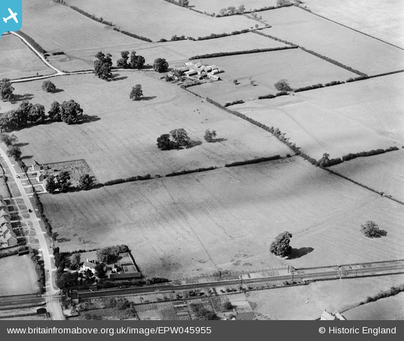
EPW045955 ENGLAND (1934). Earthworks of the medieval village and moated sites at Thrupp End Farm, Lidlington, 1934
© Copyright OpenStreetMap contributors and licensed by the OpenStreetMap Foundation. 2025. Cartography is licensed as CC BY-SA.
Nearby Images (7)
EPW045955

EPW045957

EPW045956

EPW045961

EPW045958

EPW045959

EPW045960

Details
| Title | [EPW045955] Earthworks of the medieval village and moated sites at Thrupp End Farm, Lidlington, 1934 |
| Reference | EPW045955 |
| Date | September-1934 |
| Link | |
| Place name | LIDLINGTON |
| Parish | LIDLINGTON |
| District | |
| Country | ENGLAND |
| Easting / Northing | 498899, 239368 |
| Longitude / Latitude | -0.55781286158403, 52.043454834678 |
| National Grid Reference | SP989394 |
Pins
 melgibbs |
Saturday 15th of June 2013 06:07:08 PM |