
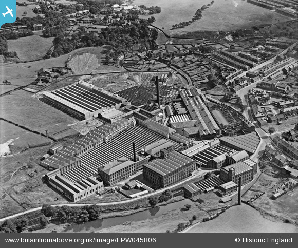
EPW045806 ENGLAND (1934). Turner Brothers Asbestos and India Rubber Works, Rochdale, 1934
© Copyright OpenStreetMap contributors and licensed by the OpenStreetMap Foundation. 2026. Cartography is licensed as CC BY-SA.
Nearby Images (14)
EPW045806

EPW045809

EPW016588

EPW045810

EPW045811

EPW045807

EPW045808

EPW016592

EPW045812

EPW016589

EPW016591

EPW016593

EPW016590

EPW045805

Details
| Title | [EPW045806] Turner Brothers Asbestos and India Rubber Works, Rochdale, 1934 |
| Reference | EPW045806 |
| Date | August-1934 |
| Link | |
| Place name | ROCHDALE |
| Parish | |
| District | |
| Country | ENGLAND |
| Easting / Northing | 388372, 414514 |
| Longitude / Latitude | -2.1758407093389, 53.626794523118 |
| National Grid Reference | SD884145 |
Pins

PSYGMON7 |
Sunday 15th of March 2015 01:05:54 PM | |
|
PSYGMON7 |
Sunday 15th of March 2015 12:44:37 PM | |
|
Mikeya |
Thursday 24th of July 2014 02:18:13 PM | |
|
Mikeya |
Thursday 24th of July 2014 02:10:20 PM | |
I think it is Hollows Farm. My Tweedale ancestors lived there from around the mid 1700's until, perhaps the 1830's. Judging by OS Maps, it was demolished in the late 1950's. |
JFB |
Tuesday 11th of December 2018 09:18:09 AM |
|
Mikeya |
Thursday 24th of July 2014 02:06:43 PM | |
|
Mikeya |
Thursday 24th of July 2014 02:05:44 PM | |
|
Mikeya |
Thursday 24th of July 2014 02:04:50 PM | |
|
PSYGMON7 |
Wednesday 13th of November 2013 05:14:27 PM | |
|
PSYGMON7 |
Wednesday 13th of November 2013 05:11:46 PM |
User Comment Contributions
What a terrible history this works turned out to have and such a legacy. |
Mikeya |
Thursday 24th of July 2014 02:11:02 PM |