
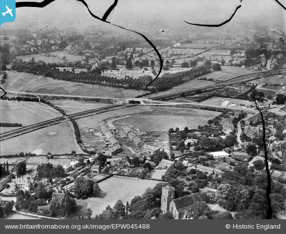
EPW045488 ENGLAND (1934). Housing under construction along Meole Crescent with Shrewsbury in the distance, Meole Brace, from the south-west, 1934. This image has been produced from a damaged negative.
© Copyright OpenStreetMap contributors and licensed by the OpenStreetMap Foundation. 2026. Cartography is licensed as CC BY-SA.
Nearby Images (6)
EPW045488

EPW045486

EPW045484

EPW045487

EPW045483

EPW045485

Details
| Title | [EPW045488] Housing under construction along Meole Crescent with Shrewsbury in the distance, Meole Brace, from the south-west, 1934. This image has been produced from a damaged negative. |
| Reference | EPW045488 |
| Date | July-1934 |
| Link | |
| Place name | MEOLE BRACE |
| Parish | SHREWSBURY |
| District | |
| Country | ENGLAND |
| Easting / Northing | 348664, 310784 |
| Longitude / Latitude | -2.7596330036104, 52.691959950767 |
| National Grid Reference | SJ487108 |
Pins

s1mon321 |
Sunday 2nd of March 2014 05:27:41 PM | |
|
Andrew Bennett |
Monday 8th of July 2013 10:31:34 PM | |
|
Andrew Bennett |
Saturday 15th of June 2013 12:32:25 AM | |
|
Andrew Bennett |
Saturday 15th of June 2013 12:30:43 AM | |
|
Andrew Bennett |
Friday 14th of June 2013 11:37:11 PM | |
|
Andrew Bennett |
Friday 14th of June 2013 11:27:31 PM | |
|
Andrew Bennett |
Friday 14th of June 2013 11:20:42 PM | |
|
Andrew Bennett |
Friday 14th of June 2013 11:19:24 PM | |
|
Andrew Bennett |
Friday 14th of June 2013 11:18:27 PM | |
|
Andrew Bennett |
Friday 14th of June 2013 11:14:59 PM | |
|
Andrew Bennett |
Friday 14th of June 2013 11:13:56 PM | |
The S&M (so aptly named from the passengers' point of view) had closed to passenger trains by 1934, but was still open (in as far as any Colonel Stephens line was ever properly open) for goods trains, and in fact the spur into Abbey station was the last remnant, only finally closing (as an oil depot) in 1988. |
Maitland |
Thursday 20th of March 2014 11:05:08 PM |
|
Andrew Bennett |
Friday 14th of June 2013 11:03:31 PM | |
|
Andrew Bennett |
Friday 14th of June 2013 11:02:45 PM | |
|
Andrew Bennett |
Friday 14th of June 2013 11:02:28 PM |