
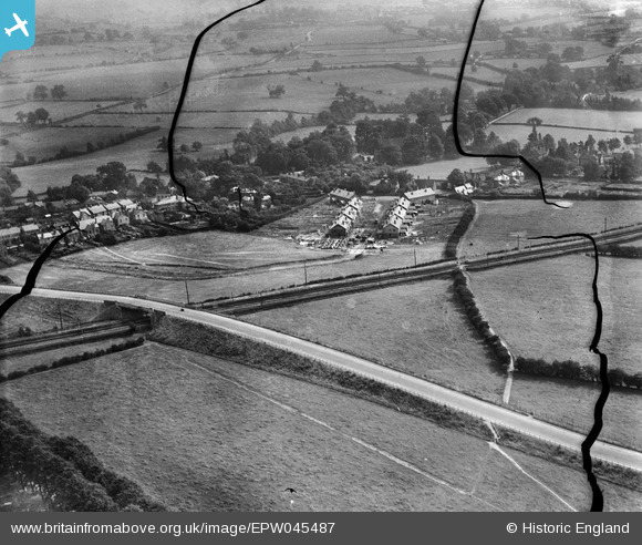
EPW045487 ENGLAND (1934). Housing under construction along Meole Crescent, Meole Brace, 1934. This image has been produced from a damaged negative.
© Copyright OpenStreetMap contributors and licensed by the OpenStreetMap Foundation. 2026. Cartography is licensed as CC BY-SA.
Nearby Images (6)
EPW045487

EPW045488

EPW045484

EPW045483

EPW045486

EPW045485

Details
| Title | [EPW045487] Housing under construction along Meole Crescent, Meole Brace, 1934. This image has been produced from a damaged negative. |
| Reference | EPW045487 |
| Date | July-1934 |
| Link | |
| Place name | MEOLE BRACE |
| Parish | SHREWSBURY |
| District | |
| Country | ENGLAND |
| Easting / Northing | 348683, 310850 |
| Longitude / Latitude | -2.7593621770241, 52.692555084793 |
| National Grid Reference | SJ487109 |
Pins
Be the first to add a comment to this image!