
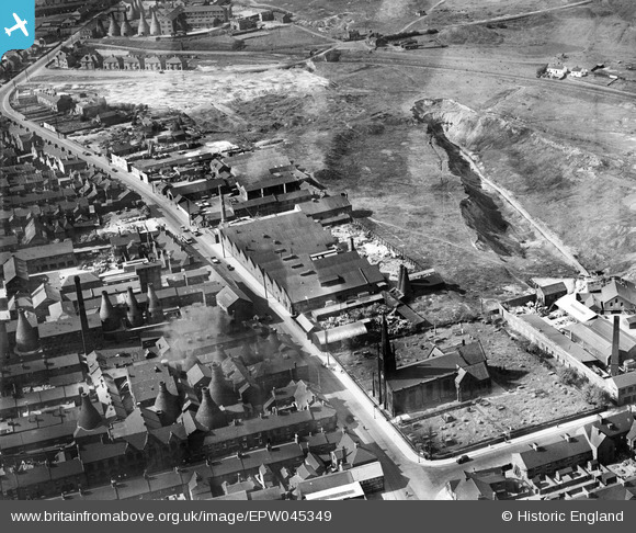
EPW045349 ENGLAND (1934). The British Earthenware Pottery and Christ Church, Tunstall, 1934
© Copyright OpenStreetMap contributors and licensed by the OpenStreetMap Foundation. 2026. Cartography is licensed as CC BY-SA.
Nearby Images (8)
EPW045349

EPW045351

EPW045347

EPW045350

EPW045348

EPW054088

EPW045346

EPW054089

Details
| Title | [EPW045349] The British Earthenware Pottery and Christ Church, Tunstall, 1934 |
| Reference | EPW045349 |
| Date | July-1934 |
| Link | |
| Place name | TUNSTALL |
| Parish | |
| District | |
| Country | ENGLAND |
| Easting / Northing | 385900, 351824 |
| Longitude / Latitude | -2.2104292959622, 53.063173600586 |
| National Grid Reference | SJ859518 |
Pins

bescotbeast |
Sunday 15th of September 2013 03:43:47 PM |