
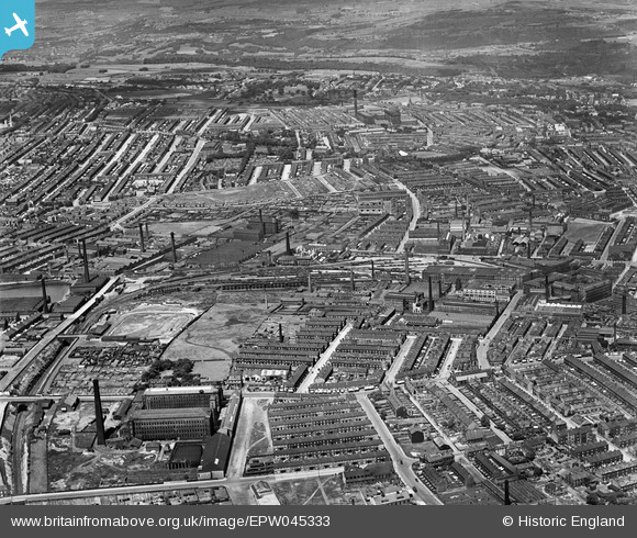
EPW045333 ENGLAND (1934). The City Road Goods Station, the Legrams Worsted Mill and the surrounding residential area, Bradford, 1934
© Copyright OpenStreetMap contributors and licensed by the OpenStreetMap Foundation. 2026. Cartography is licensed as CC BY-SA.
Nearby Images (2)
EPW045333

EPW024500

Details
| Title | [EPW045333] The City Road Goods Station, the Legrams Worsted Mill and the surrounding residential area, Bradford, 1934 |
| Reference | EPW045333 |
| Date | July-1934 |
| Link | |
| Place name | BRADFORD |
| Parish | |
| District | |
| Country | ENGLAND |
| Easting / Northing | 414875, 433556 |
| Longitude / Latitude | -1.7741429862582, 53.797882241997 |
| National Grid Reference | SE149336 |
Pins

Shipley Flyer |
Sunday 4th of June 2023 10:54:39 PM | |
|
John N |
Friday 23rd of October 2020 05:45:42 PM | |
|
John N |
Friday 23rd of October 2020 05:44:27 PM | |

navaho56 |
Sunday 22nd of January 2017 09:54:02 PM | |
|
nazman |
Sunday 22nd of January 2017 07:18:31 PM | |
|
nazman |
Sunday 22nd of January 2017 07:14:39 PM | |
|
nazman |
Sunday 22nd of January 2017 07:12:52 PM | |
|
nazman |
Sunday 22nd of January 2017 07:08:01 PM | |
|
Paul McGowan |
Tuesday 9th of February 2016 12:36:44 PM | |
|
Paul McGowan |
Tuesday 9th of February 2016 12:31:30 PM | |
|
Paul McGowan |
Tuesday 9th of February 2016 12:30:42 PM |
