
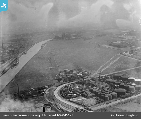
EPW045127 ENGLAND (1934). Land next to Wharf 60, Trafford Park, from the south-west, 1934
© Copyright OpenStreetMap contributors and licensed by the OpenStreetMap Foundation. 2026. Cartography is licensed as CC BY-SA.
Nearby Images (4)
EPW045127

EPW045126

EPW027472

EPW027486

Details
| Title | [EPW045127] Land next to Wharf 60, Trafford Park, from the south-west, 1934 |
| Reference | EPW045127 |
| Date | July-1934 |
| Link | |
| Place name | TRAFFORD PARK |
| Parish | |
| District | |
| Country | ENGLAND |
| Easting / Northing | 377422, 397598 |
| Longitude / Latitude | -2.3402043775439, 53.474375011881 |
| National Grid Reference | SJ774976 |
Pins

Stretfordian |
Wednesday 3rd of August 2016 11:37:09 PM | |
|
Stretfordian |
Wednesday 3rd of August 2016 11:36:26 PM | |
|
Stretfordian |
Tuesday 17th of May 2016 01:11:40 AM | |
|
Stretfordian |
Tuesday 17th of May 2016 01:10:43 AM | |
|
Stretfordian |
Tuesday 17th of May 2016 01:09:50 AM | |
|
Stretfordian |
Tuesday 17th of May 2016 01:08:59 AM |